Utilisation de l'application
Store deep link or Web Store URL
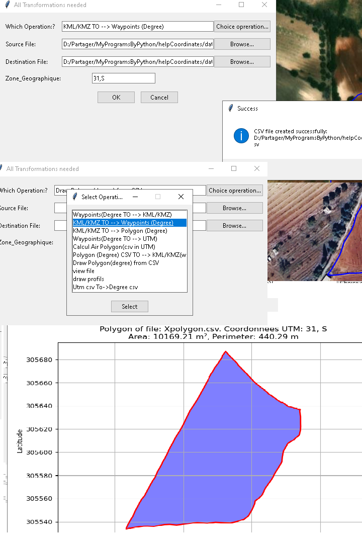
Menu principale: extraction kml_waypoints
multi_choix
• Extract from files in *.klm, *.kmz polygon, waypoints to format *.csv
• Convert *.csv files degree to *.csv files UTM (m).
• Convert *.csv files UTM(m) to *.csv files Degree.
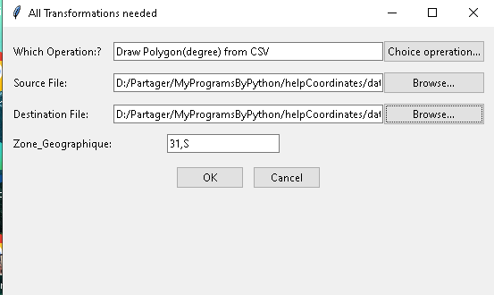
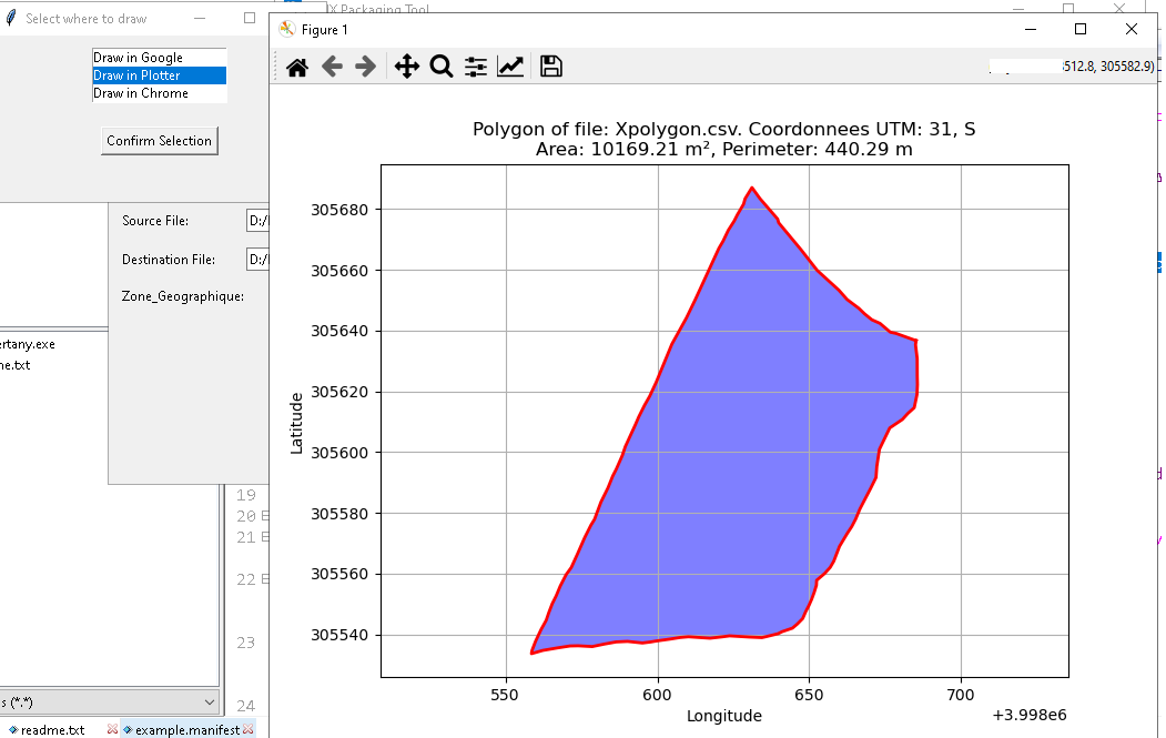
• Draw profiles,polygons from *.csv files UTM(m). in Plotter or google Earth, chrome.
• View Files and modify or save themes.
• calculate Aire and perimeter and save data in csv file.

view polygon created in google Earth : easy to draw
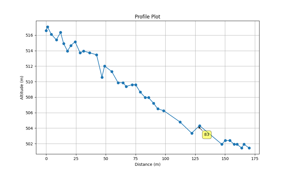
drawing in plotter
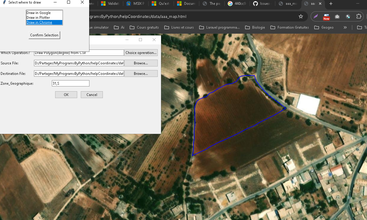
view polygon in chrome
view drawing in plotter